Important notes
To use the software correctly, the following rules must be respected:
- Reference system: the slope must be defined in the positive quadrant of a Cartesian reference system X, Y.
- The Y coordinate must increase from left to right.
- Sections defined with respect to reference systems other than the required one can be mirrored using the Mirror command.
- The distance between the minimum Y ordinate of the profile vertices and the depth of the bedrock is a constraint on the search for the safety factor (sliding surfaces that cut below it will not be taken into account).
- The geotechnical properties of the layers that make up the slope to be examined must be assigned starting from the upper layer down to the lower one.
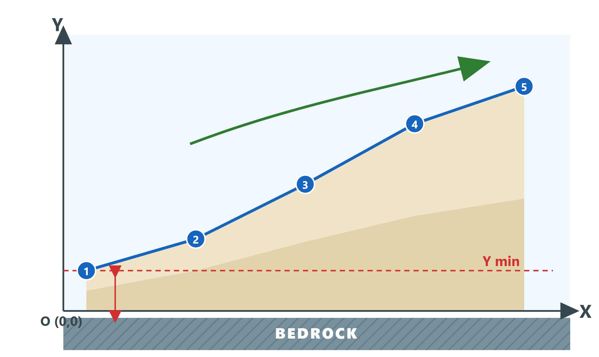
The profile is defined in the positive quadrant, with numbered vertices and the Y coordinate increasing from left to right. The dashed line marks the minimum Y of the profile: the bedrock must lie below it.
Common mistake
Drawing the profile from right to left, with the Y coordinate increasing in that direction, does not respect the convention and leads to invalid results. If the section was surveyed with the opposite orientation, it must be mirrored with the Mirror command before the analysis.